Problem:
|
County lacks a tool to track public art throughout communities.
|
Solution:
|
Launch a public art map and database that consists of art installments throughout the county.
|
All roads lead to art for county residents in Macomb County, Mich. with the help of an interactive map that tracks art installments throughout the community.
The Macomb County Department of Planning and Economic Development launched the Interactive Map of Public Art in 2018. The crowdsourced database tracks art installments throughout the county.
Leaders from OneMacomb, an initiative that promotes diversity and inclusion in the arts, approached the department and asked for the development of a public art-based platform, according to Megan Ochmanek, a communications specialist for the Macomb County Department of Planning and Economic Development.
Learn More
View the Macomb County Interactive Map of Public Art
Macomb County’s Public Art Map and Database is the recipient of a 2019 NACo Achievement Award in the Arts, Culture and Historic Preservation category.
County leaders identified a need to promote public art in the county because there was no existing database or list that tracked art in the county’s communities.
The Geographic Information System (GIS) team within the Department of Planning and Economic Development built the platform to allow the public to find art throughout the county, Ochmanek said. A GIS specialist created the mobile and online application.
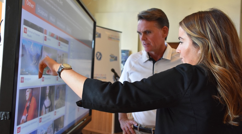
“People can click it, a little image pops up that says here’s the art, here’s where it’s located, here’s any story or information we have on a piece,” Ochmanek said. “It becomes a really great resource for the public.”
Initially, the Macomb County Department of Planning and Economic Development incorporated known pieces of public art by using information provided by local communities and art centers.
A unique aspect of the public art map is its crowdsourcing feature, which allows members of the community to submit art installments to the map using a Google form, Ochmanek said. The database grew as county residents contributed photos and information about public art throughout the county.
“We really needed to turn to our community to find out where the art was by using their vast knowledge and resources to map our county’s art,” Ochmanek said.
She added that this process allows the public to participate in the public art process and be a part of a greater movement in public art.
When an individual submits a piece of art, the department vets each submission, which must be approved before it is included on the map, explained Jeff Schroeder, deputy director of the Department of Planning and Economic Development.
“I think our communities are getting insight to installments and pieces they didn’t realize were within their boundaries,” he said.
The map is user-friendly and organizes art installments into different categories such as murals, sculptures, architecture or paintings. Users can click on different tabs and view previewed images and background information on different art pieces. A map on the side of the screen shows pinpointed locations for each installment.
The free platform, which includes over 150 art installations, is available to anyone and accessible on a computer, tablet or phone.
“Anyone can use it and find something to do,” Ochmanek said. “If you don’t have the budget to go out and travel, you can have a staycation in Macomb County by using this map and planning your own art trail.”
Ochmanek noted that art adds value to a community by adding economic and community growth through highlighting public art in local communities. “As county leadership, we wanted to make sure we were highlighting what our individual communities were doing,” she said.
The county partnered with local organizations and agencies such as the Detroit Institute of Arts, the Starkweather Arts Center and the Anton Art Center to launch the map.
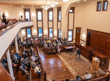
The department’s communications team created a marketing plan to promote the tool which included a launch event, social media campaigns, graphics for the map, a webpage, invitations, social media and program books. Additionally, following the launch, a social media contest asked individuals to submit art installments to the map over six weeks. Every two weeks, the county randomly selected winners who received prizes donated by local art organizations.
“There’s also a more localized benefit where we’re bringing people together of all races, ethnicities, genders and age demographics to come experience these things in our community,” she said. “We’re hoping that fosters relationship growth, connection, placemaking in our community.”
The map, which is still accessible and open to receive submissions, lives on an existing GIS enterprise platform, which the county subscribes to yearly. There were no additional funds to create the database.


